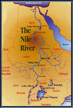
The Nile Riveris the longest river in the world. From its major source, Lake Victoria in east central Africa, the White Nile flows generally north through Uganda and into Sudan where it meets the Blue Nile at Khartoum, which rises in the Ethiopian highlands. From the confluence of the White and Blue Nile, the river continues to flow northwards into Egypt and on to the Mediterranean Sea. From Lake Victoria to the Mediterranean Sea the length of the Nile is 5584 km (3470 mi). From its remotest headstream, the Ruvyironza River in Burundi, the river is 6671 km (4145 mi) long. The river basin has an area of more than 3,349,000 sq km (1,293,049 sq mi).

Source:
Lake VictoriaThe White NileThe Ruvyironza, regarded as the ultimate source of the Nile, is one of the upper branches of the Kagera River. The Kagera follows the boundary of Rwanda northward, turns where the borders of Rwanda, Uganda and Tanzania meet, and drains into Lake Victoria. On leaving Lake Victoria at the site of the now-submerged Owen Falls, the Nile rushes for 483 km (300 mi) over rapids and cataracts, at first northwest and then west, until it enters Lake Albert. The section between the two lakes is called the Victoria Nile. The river leaves the northern end of Lake Albert as the Albert Nile, flows through northern Uganda, and at the Sudan border becomes the Bahr al Jabal. At its junction with the Bahr al Ghazal, the river becomes the Bahr al Abyad, or the White Nile. Various tributaries flow through the Bahr al Ghazal district. At Khartoum the White Nile is joined by the Blue Nile, or Bahr al Azraq. These are so named because of the colour of the water.

Source:
White NileThe Blue NileThe Blue Nile (in Arabic the Al Bahr al-Azraq), 1529 km (950 mi) long, gathers its volume mainly from Lake T’ana, in the Ethiopian Highlands; it is known here as the Abbai. The Blue Nile rises at a spring site upstream of Lake Tana in Ethiopia, 2,150 m (7,054 ft) above sea level. The river flows west then north until it eventually meets the White Nile at Khartoum. A length of 800 km/500 mi is navigable during high water times. Some 80% of Sudan's electricity is provided by hydroelectric schemes at Roseires and Sennar, and these dams provide irrigation water for over 10,000 sq km/3,860 sq mi of the Gezira Plain.

Source:
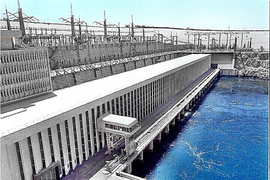
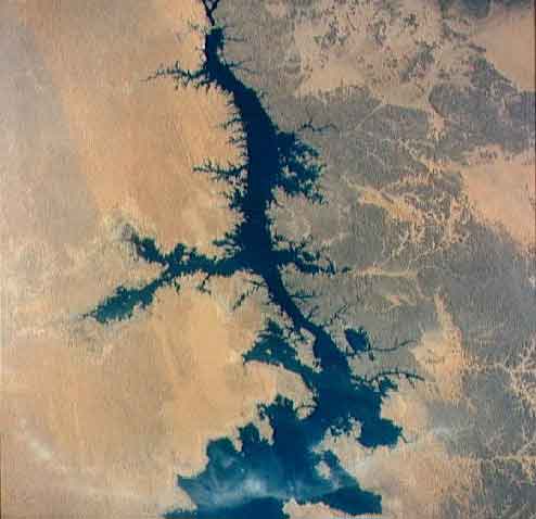
Blue Nile FallsThe Main NileFrom Khartoum the Nile flows northeast. 322 km (200 mi) below Khartoum it is joined by the ‘Atbarah River. The black sediment brought down by the 'Atbarah and Blue Nile Rivers used to settle in the Nile delta making it very fertile. This process historically occurred during the annual flooding of the Nile in the summer months. However, the opening of the Aswan High Dam in the early 1970s allowed for control of the flooding and reduced sediment deposits in the river as these now settle in Lake Nasser. During its course from the confluence of the ‘Atbarah through the Nubian Desert, the river makes two deep bends. From Khartoum to Aswan there are six cataracts. The Nile is navigable to the second cataract, a distance of 1,545 km (960 mi). The delta of the Nile is 190 km (120 mi) wide. The water level behind the Aswan Dam fell from 170 m (558 ft) in 1979 to 150 m (492 ft) in 1988, threatening Egypt's hydroelectric power generation.

Source:
Aswan High DamSource:
http://ensap.nilebasin.org/index.php?option=com_content&task=view&id=58&Itemid=76